An interactive historical map of The Heavens
There’s a local beauty spot called “The Heavens”. It’s a short walk from my house. It has beautiful views, a stream, a huge tree swing, a couple of fire pits, and it’s in a small, enclosed valley which makes it ideal for relaxing while keeping an eye on your kids.
Local archaeologist Neil Baker has studied history of the area for a long time, and does regular Archaeology Walks there, based around is Heavens Archaeological Research Project. He has a bunch of very interesting old maps of the area that are not currently available online.
I took one of them (I think from the 17th century), and georeferenced it against a Victorian map. I’m writing this up long after I did the work, so I don’t have the actual details of what I did to hand; so just recording it here for future reference:
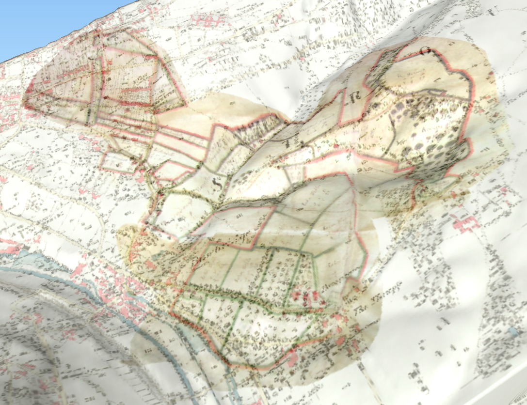
You can zoom around the map here; I wrote about the techniques I used in an earlier post about mapping Stroud.